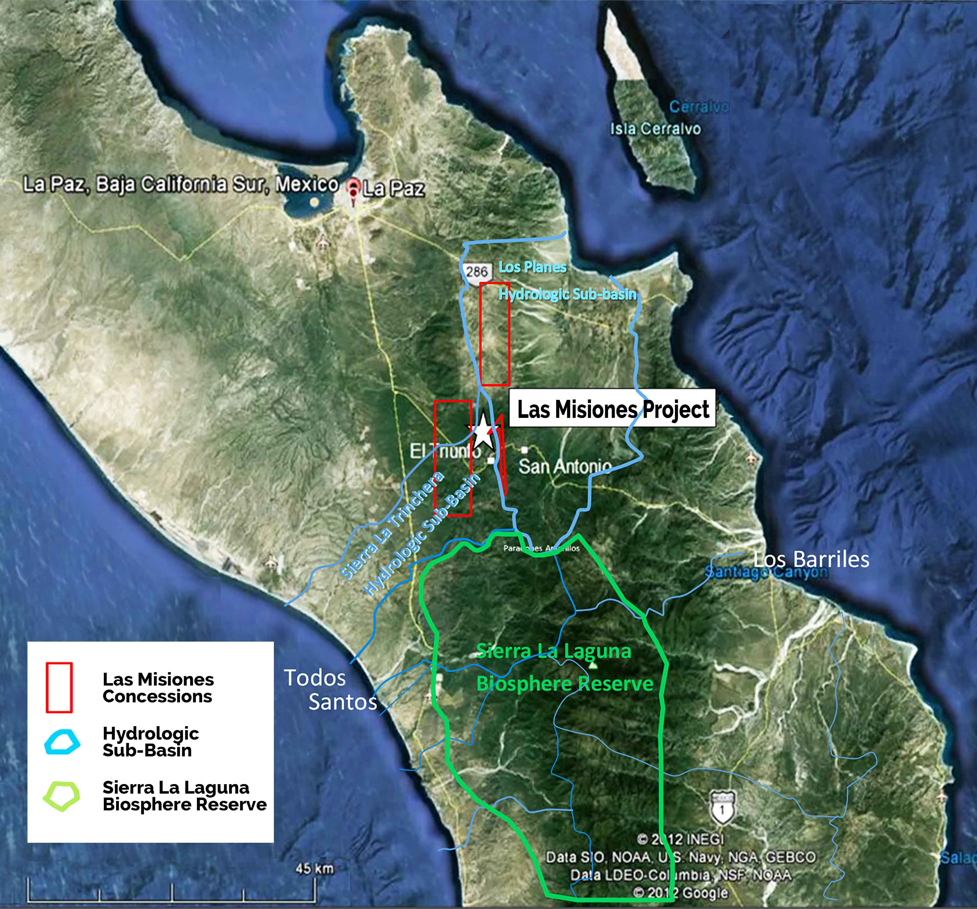
LOCATION:
San Antonio, Baja Peninsula
SIZE:
15,067 hectares
RESOURCES:
Gold-Copper-Silver
PROJECT OVERVIEW
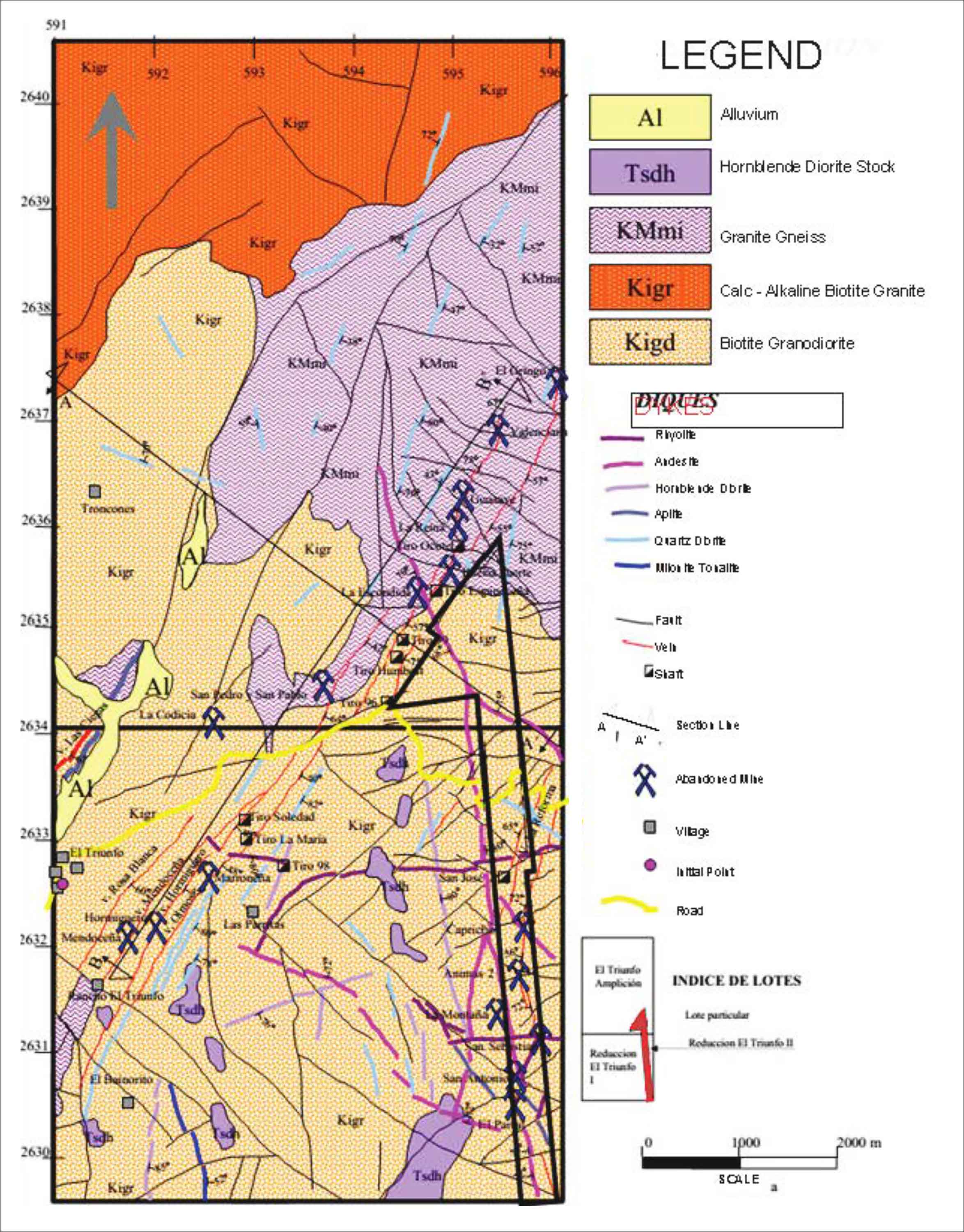
Las Misiones project is in the Baja Peninsula and is adjacent to the historic mining town of San Antonio, 40 km southeast from the state capital and port city of La Paz. The Las Misiones Property is comprised of 6 mining concessions covering 15, 067 hectares. The property has a strike length of 15 km from the north to south trends. The mineralization at Las Misiones has been identified over a strike length of approximately 1.8 km and is subdivided into four fault-bounded zones referred to from North to South. Historic drilling suggests that the mineralization is of mesothermal or orogenic origin. There are several mineralized shear/vein systems on the Las Misiones Property with many secondary and cross veins. Shear zones related to thrust faulting exceed 200 m thickness and are regionally traceable over 45 km.
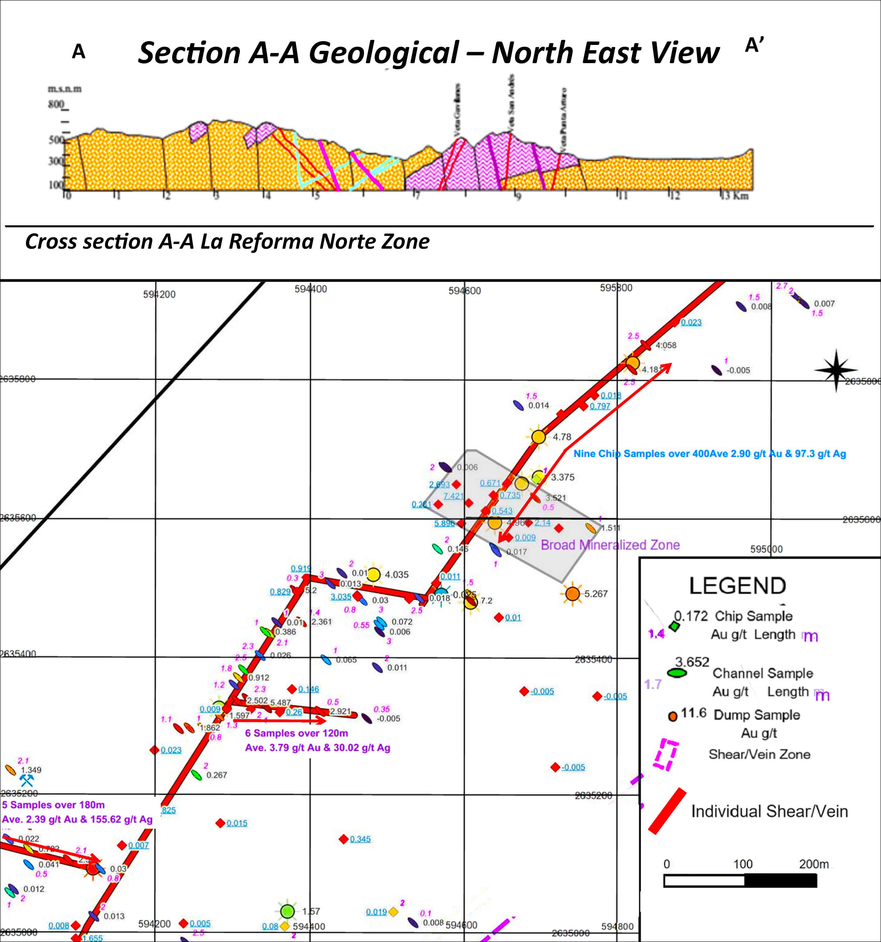
ZONE #1 — THE LA REFORMA NORTE SHEAR ZONE
There are three Main Gold Zones at Las Misiones. The Zone #1 highlights include:
- A north-south zone broken into subunits trending 1.5 km long and situated near the northern end of Concession # 218918. Many small, isolated shear/veins are situated within this zone.
- A primary structure that displays a sigmoidal shear/vein set that has been identified from the sampling program of Azul. East-west trending shear/veins occur as offshoots from the main zone.
- The northern tip of this sub-zone has a shear/vein that extends for 400m and varies in width from 1.5 to 3.5 meters. Nine Azul chip samples reported an average grade of 2.67 g/t Au.
- A 2.3-hectare area at the southern end of this shear/vein returned an average grade of 2.39 g/t Au and 155.62 g/t Ag,
- Six chip samples collected by Azul from a 120m long offshoot shear/vein in the southern part of the area returned an average grade of 3.79 g/t Au and 30.02 g/t Ag.
A 180m–long, southernmost segment chip sampled by Azul at 5 locations and returned an average grade of 2.39 g/t Au and 155.62 g/t Ag

